Out and About – Broomhill Park
By Theresa & Richard Emmett and Thelma & Graham Dudley
Where is it?
Broomhill Park is part of the North Downs and is near King Arthur’s Drive in Strood, Rochester, Kent. Postcode: ME2 3NB.
Map reference TQ731702.
The site is managed by the Friends of Broomhill Park, its free, open 24 hours and there is a small parking area at this postcode (limited to about 14 spaces), but there are lots of streets nearby you may be able to park in too.
What is physically there?
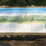
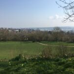
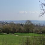
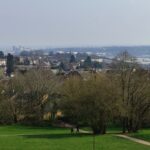
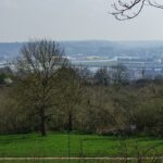
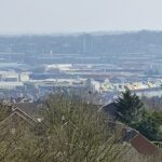
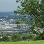
Woodland, open spaces, a picnic area, fitness equipment, walking routes, wildflower area, sculptures, lots of seating facilities, a human sun dial, car parking and beautiful views over the river Medway.
It’s History? (thanks to www.friendsofbroomhill.org.uk)
Broomhill is part of the North Downs ridge of chalk that finishes on the Hoo Peninsular and was formed in the cretaceous period. Chalk was quarried at Broomhill from Roman times until the last quarry was closed in the middle of the 20th century. There were also several lime kilns on the site from the Middle Ages which were still in use until the 19th Century. Evidence has been found at Piper’s House Farm that the chalk pits were used as refuges by Ancient Britons when under attack. An Anglo-Saxon grave was found on the site which contained a spearhead, knife and bronze ring set with an amethyst which can be seen in Rochester Museum.
Through history, the summit has been used strategically in battle. Legend has it that Boudica and the Iceni massed ready to swoop on the Romans as they sent their advance guard wading across the Medway. In 1264 Simon de Montfort, Earl of Leicester and leader of the 2nd Barons’ uprising, used Broomhill to plan his strategy for capturing Rochester Castle. When the rebellion in 1554 against Queen Mary marrying Philip of Spain failed, Norfolk and other royalists escaped over the hill to Gravesend.
During the time of the Spanish Armada, Broomhill was part of the chain of early warning beacons set up from strategic points along the south coast, criss-crossing Sussex, Surrey and Kent to London. In 1606 James I and his family showed off the Dockyard to King Christian IV of Denmark from the hill and forty years later, during the Civil War, Cromwell’s troops were ambushed there before they eventually captured Rochester.
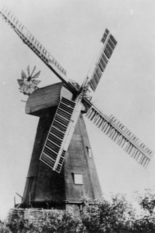
The site was also home to 6 windmills on all sides of the hill until the beginning of the 20th Century. There are two with known photos. Field’s Mill, (pictured left) and Killick’s Mill, (pictured right) formed a pair of windmills that stood on Broom Hill. In Dickens’ times the Miller was a Mr Clark, but the owner was Mr Field. Mr Field was an amateur musician, who kept a piano, a harp, and a barrel organ in his sitting room.
It is said that the organ was bought from Loose Church, and so fixed that the power from the mill turned the organ’s handle. Dickens would visit the Mill, on his walks and listen to the organ music. Fields Mill burnt down in 1875. Killicks Mill was built in 1819, this one had 6 sides as opposed to the more usual 8-sided mills.
The cap was blown off for the second time in 1880. It was replaced and worked again for a year in 1890 but was unprofitable and it stood derelict until it was pulled down in the 1920s.
In the early 19th century, navvies tunnelled under Broomhill to construct the Gravesend to Strood canal, which was subsequently filled in and is now used for the railway line. After the 1st World War, allotments were plotted out and sold, some are still there. By this time housing development had also begun to creep up the hill.
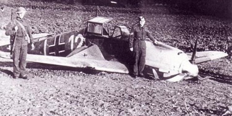
In more recent times, during the 2nd World War, a German Messerschmitt plane crashed on the hill. The wounded pilot was helped by a young woman before being taken to Chatham Police Station by the Home Guard with fixed bayonets, followed by an angry crowd of housewives wielding brooms and spades.
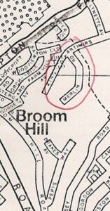
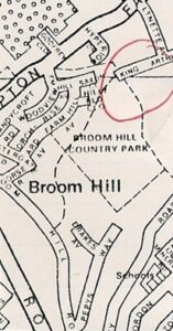
In 1946-47 some 100 prefab bungalows were built on the top of the hill because of the housing shortage. The prefabs were all demolished by 1977 when, after a public outcry over Council plans to build ten detached houses on the hill, the summit was declared a park to prevent any further incursion on one of Medway’s green spaces.
The map on the left from 1970, shows Merlin Road and an extended King Arthur’s Drive, before the creation of the Park. This is where the prefabs were.
The map on the right from 1988, shows that Merlin Road had disappeared, along with a section of King Arthur’s Drive that is now the car park.
Why Visit?
The area is a hidden gem, that has breath-taking views and a tranquillity about it that is jus on our doorstep.
Let us know what you think when you visit: Contact us
More Out and About
For more places to visit Click Here.